FULL Guide of Sydney Public Transport: Map, Info, Prices
Welcome to the full guide to Sydney Public Transport! Whether you're a first-time visitor or a seasoned local, understanding the transportation system in Sydney is crucial for an efficient and enjoyable experience. This guide will provide you with all the information you need, from maps and prices to tips for using various modes of transport in Sydney.
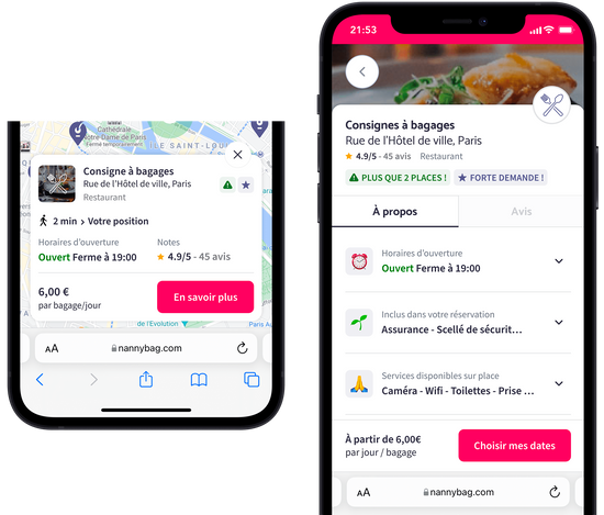
For hassle-free travel around Sydney, consider using Sydney luggage storage central station services by Nannybag. Store your luggage securely and explore the city without heavy bags.
Sydney Public Transport Overview
Sydney's comprehensive transportation system includes Sydney trains, Sydney ferries, Sydney buses, and the Sydney light rail. These services connect all major attractions like the Sydney Opera House, Sydney Harbour Bridge, Taronga Zoo, Manly Beach, and the Central Business District, making transport in Sydney convenient for all travelers.
How much does Sydney Public Transport cost?
Opal Card: Your Key to Sydney Transport
The Opal card is an essential tool for navigating Sydney's public transport. It's a smartcard that you can top up and tap on and off on trains, buses, ferries, and light rail.
- Adult Fares: The average cost per trip is around AUD $3.50 to $4.50.
- Concessions: Reduced fares are available for eligible students, seniors, and pensioners.
- Daily Cap: Maximum charge of AUD $16.10 per day, allowing unlimited travel.
- Weekly Cap: Spend no more than AUD $50 per week.
- Airport Access Fee: Traveling from Sydney Airport includes an additional fee.
Zones and Peak Hours
Sydney's transport system is divided into zones, and fares vary depending on how many zones you travel through. Peak hours typically see higher fares and can be busier, so plan accordingly.
Navigating with a Map of Sydney
Essential Tool for Exploration
A map of Sydney is an indispensable tool for any traveler navigating the city. Whether you are exploring the bustling streets of the Central Business District or planning a day trip to the beach, a comprehensive map can help you understand the city's layout and public transport options.
Accessibility and Convenience
Maps are readily available at key locations such as train stations, ferry wharves, and buses. These physical maps are great for on-the-go reference. Additionally, digital versions of Sydney maps can be downloaded onto smartphones or tablets for tech-savvy travelers. These digital maps often offer interactive features and real-time updates and can be customized based on your location and destination.
Route Planning
With a map, you can easily plan routes to popular destinations such as Bondi Junction, known for its shopping and proximity to Bondi Beach; Darling Harbour, a hub of entertainment and dining; and Surry Hills, famed for its cafes and boutique shops. Maps also highlight the best public transport routes, making it easier to navigate the city efficiently.
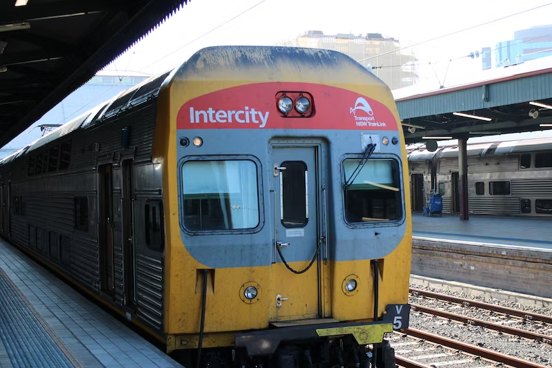
Sydney Trains: Fast and Efficient
Expansive Network
Sydney's train services offer a fast and efficient way to cover long distances across the city and beyond. The network connects major districts, residential areas, and tourist attractions, making it a popular choice for locals and visitors.
Key Stations and Connections
Central Station is the heart of Sydney's train network, providing connections to various lines that span the city and suburbs. Bondi Junction station serves as a crucial link to the famous Bondi Beach, with regular services that make beach trips convenient. Other key stations like Town Hall and Wynyard offer easy access to Sydney’s main commercial and tourist areas.
Sydney Buses: Extensive Coverage
Reaching Every Corner
While trains and ferries cover the main routes, Sydney's extensive bus network reaches areas beyond the reach of rail services. Buses provide vital connections to suburbs, beaches, and special attractions. They are particularly useful for short trips within suburbs and for reaching destinations not serviced by train or ferry.
Flexibility and Frequency
Sydney's buses run frequently, with routes that cover both main roads and quieter suburban streets. This flexibility makes them a great option for exploring local neighborhoods or for journeys where trains and ferries aren't suitable.
Sydney Ferries: Scenic and Relaxing
Unique Perspective of the City
Sydney's ferry services provide a chance to experience Sydney's beautiful harbor and coastline from a different perspective.
Popular ferry routes include services to Manly Beach, offering spectacular views of the Sydney Harbour Bridge and Opera House en route, and to Taronga Zoo, where the journey is as enjoyable as the destination. Ferries also connect to other scenic spots like Watsons Bay and Rose Bay, making them a favorite choice for both scenic enjoyment and efficient travel.
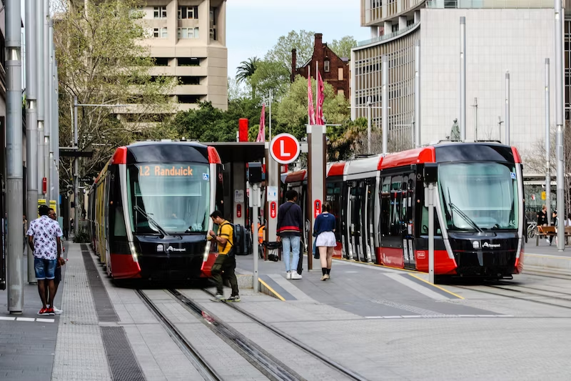
Sydney Light Rail: Convenient City Travel
Smooth and Accessible
The Sydney light rail is a key element of the city’s public transport network, providing a smooth and accessible way to navigate through the Central Business District (CBD) and beyond. It operates on multiple lines, connecting major attractions, shopping districts, and residential areas.
Exploring Key Destinations
The light rail lines include stops at significant points of interest, such as Darling Harbour, a popular entertainment area, and the Sydney Fish Market, a must-visit for seafood lovers. It also connects to more residential areas, providing insights into everyday Sydney life beyond the typical tourist spots.
Efficient and Frequent Service
The service is frequent and efficient, with modern, comfortable trams that offer a pleasant ride. It's particularly useful for short hops between downtown locations where walking might take longer and driving isn't practical due to traffic or parking challenges.
Additional Tips for Sydney Public Transport
Use Digital Tools
Downloading transport apps can significantly enhance your travel experience in Sydney. These apps provide real-time updates on schedules, delays, and even crowd levels, helping you plan your journey more effectively. They can also assist in route planning, fare calculation, and identifying the nearest stops or stations.
Travel Comfortably
To ensure a more comfortable journey, avoid traveling during peak hours. Typically, These are early mornings and late afternoons on weekdays when locals commute to and from work. Traveling outside these times can mean less crowded buses, trains, and ferries, making your journey more relaxed and enjoyable.
Be Aware of Service Schedules
It’s important to check the last service times for trains, buses, and ferries, especially if you plan to stay late. Sydney's public transport services have specific closing times, and missing the last connection could mean opting for a taxi or rideshare service, which might be more expensive.
Additional Considerations
- Always have your Opal card or contactless payment method ready to speed up boarding times.
- Be mindful of designated quiet carriages on trains, where noise is minimal.
- Check for any planned service changes or track work, especially on weekends, as this could affect your travel plans.
Say hello to exploring and goodbye to heavy bags!
What if you could enjoy every minute in the city without the burden of your bags?
- Safe luggage storage for a flat daily price of A$7.50/luggage item
- Included luggage protection of up to €10000 in case of breakage, loss or theft
Keep Nannybag in your pocket!